Quick answer: Karnataka has redesigned the RTC, also called the pahani, under Form 16-A. The redesign was issued through Government Order RD-LGP/37/2026, dated 9 September 2026, according to reports of the order. The new format is reported to add Aadhaar-seeded owner details in masked form, a Farmer ID, a 14-digit ULPIN, an Open Location Code, a geo-referenced survey sketch, an overview map, and a QR code for digital checks. The order is reported to leave the legal character of the RTC unchanged, and older RTCs remain valid. The new format does not replace the sale deed, the mutation records, the Encumbrance Certificate, or a title review by a property lawyer. Confirm the order text and the rollout date on the official portals before you rely on any detail.
For years, a Karnataka buyer has asked a simple question that has been hard to answer with full confidence: does this RTC match this land and this owner? A name and survey number on a printed pahani did not show where the parcel sits on a map, whether the person in front of you is the recorded holder, or whether the paper is a genuine record. The redesigned form aims to close that gap. This guide explains what the new RTC contains, how it differs from the older record, how to read its key sections, and what a buyer should still check.
What Is Form 16-A?
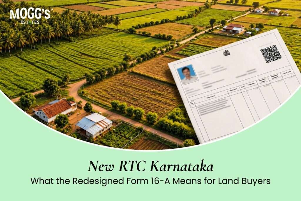
The RTC, which stands for Record of Rights, Tenancy and Crops, is the core land record for agricultural land in Karnataka. Its prescribed format is Form 16-A. The Revenue Department’s order of 9 September 2026 is reported to revise that form, bringing together identity, location, and digital verification in one document.
According to the order as reported, the change follows progress in statewide digitisation, Aadhaar linking, and the integration of land records with spatial data such as survey sketches. The order is reported to state that the redesign does not change the legal character of the record. An RTC records possession and revenue information. It is not an absolute title deed, but the new format is designed to make it more reliable and easier to check.
Why the Format Was Redesigned
Karnataka began digitising land records under the Bhoomi system in the early 2000s, moving many manual village records into a computer database. That reduced the scope for some kinds of manual error and delay. However, the text records did not show where a parcel sat geographically. The owner was also recorded as a name, with no reliable way to confirm which person with that name held the land.
Since then, the state has added property registration software, digitised survey and sub-division records, and linked more databases. The new format is reported to bring identity, textual rights, and spatial information together on one record. The purpose is to give banks, buyers, and registration offices a way to check the record against live government systems.
What the New RTC Is Reported to Include
Reports of the order describe the following additions.
Aadhaar-seeded owner details: The owner’s particulars are reported to be linked to the Aadhaar database. The Aadhaar number is shown in masked form, so that only the last few digits appear. The reported purpose is to confirm identity more reliably at registration and in later transactions.
Farmer ID: A unique identifier for the recorded holder is reported to appear on the form. It is expected to support scheme applications and direct benefit payments. Check the Farmer ID registration on the official FRUITS portal.
ULPIN and Open Location Code: Each parcel is reported to carry a ULPIN, a 14-digit unique land parcel identifier, and an Open Location Code, a short location code that can be entered in a mapping application.
Geo-referenced survey sketch and overview map: The record is reported to include a survey sketch linked to the land’s coordinates, and a wider map of the survey number or hissa. The map is described as indicative, so it is a visual aid, not a replacement for a survey.
Akarbandh linkage: The land’s extent, boundaries, and classification are reported to be linked to the Akarbandh records, which hold the official survey and classification data.
QR code: A QR code on the printed record is reported to link to the live government record, including the mutation register and encumbrance information. Scanning it should show the current official data, which can be compared with the paper in hand.
Digital generation and authentication: The form is reported to be generated and digitally signed through the state’s land record system, with a barcode and a unique RTC number.
Older RTC Versus the New Form 16-A
| Feature | Older RTC | New Form 16-A (as reported) |
|---|---|---|
| Owner identity | Name in text, with no reliable identity check | Masked Aadhaar link and a Farmer ID |
| Parcel identification | Survey number and hissa | Survey number, hissa, ULPIN, and Open Location Code |
| Maps | No map on the record | Geo-referenced sketch and overview map |
| Verification | Often needed a visit to the taluk office | QR code for digital checks |
| Linked records | Separate searches for mutation and encumbrance data | QR links to mutation and encumbrance data, where available |
| Authenticity | Printed paper, easier to alter | Digitally signed, with barcode and unique number |
The overall aim is proof: proof of who owns the land, where it is, and that the document is genuine. Careful buyers already run these checks. The new form brings more of them into one record.
Understanding ULPIN and the Open Location Code
ULPIN is the Unique Land Parcel Identification Number. It is reported as a 14-digit alphanumeric code, introduced under the national land records modernisation programme. It is intended to identify one parcel uniquely. If an RTC shows a ULPIN, the record has been linked to a surveyed parcel in the state’s digital system. Check the ULPIN on the paper against the ULPIN on the official portal, and do not treat the presence of a code alone as proof of boundaries.
The Open Location Code, also known as a Plus Code, converts a latitude and longitude into a short code that can be typed into a mapping app. It helps a buyer or a bank find the parcel without relying on a vague local landmark. A rural plot may have no street address, so a precise code can be useful. Confirm the location against the survey sketch and on the ground before you rely on it.
The Main Sections of the RTC
The RTC still contains the same core information. The new form may arrange it differently, so confirm each field against the official specimen. The following sections are the ones buyers most often need to read.
Ownership details: This section lists the sole or joint owners, the share of each owner, and, in the new format, the masked Aadhaar and Farmer ID. It also shows the mutation entry through which the current owner acquired the land. Trace that mutation to confirm that the acquisition was recorded properly.
Extent and classification: This section gives the total area of the survey number and how it is divided. It may show uncultivable land, which Karnataka records as Kharab. The distinction matters. Some Kharab land belongs to the owner, while other Kharab land may belong to the government and may not be transferable. Ask for the classification details in writing, and have a lawyer confirm what they mean for the plot.
Liabilities and encumbrances: This section records crop loans, other loans, and any pledge of the land. A recorded liability should be explained and discharged before a buyer can take clear title. Check the Encumbrance Certificate as well, because the RTC is not a full record of registered charges.
Tenancy and cultivation: This section shows who cultivates the land and which crops are grown. A tenant or a cultivator entry can raise legal questions, because tenancy rights under Karnataka’s land laws can be significant. A buyer who sees such an entry should take legal advice before going further.
What the New Format Changes for Buyers
Faster checks: A QR code and a ULPIN can help a legal team trace mutation history and encumbrances more quickly. Many buyers still need a full title search, but the record can make the early stages easier to organise.
Clearer location: The survey sketch and the Open Location Code help show where a parcel lies. This is useful when comparing the paper with the land on the ground.
Stronger identity checks: The Aadhaar link and Farmer ID may make impersonation harder at registration. The buyer should still confirm the identity of the seller with the original documents.
Easier detection of altered paper: If a printed RTC shows details that differ from the live record, the difference becomes easier to spot. Always scan the QR code, or check the record on the official portal, rather than relying on the printout alone.
What the New RTC Does Not Do
The new form does not replace other checks, and it does not make a sale safe by itself.
- It does not confirm that the seller has a complete chain of title. That requires the sale deeds and a title search.
- It does not show every court case or pending dispute.
- It does not confirm that a plot can be used for a house, a resort, or a farmhouse. That depends on conversion, approvals, and zoning.
- It does not confirm a managed farm’s management terms, fees, or services.
- It does not show environmental or flood risks, which need separate checks.
For a full set of checks, read our guide to land due diligence for farmland, and our guide to the RTC land record in Karnataka.
Common Mistakes Buyers Make
Confusing an RTC with a khata: The RTC, or pahani, is the revenue record for agricultural land. A khata is an administrative record for property tax, usually for urban and layout plots. Having one does not mean you have the other, and neither proves that a plot has layout or building approval.
Trusting the printed paper alone: A name on the RTC does not prove that the boundaries on the ground match the sketch. Ask for the survey sketch, and compare it with the physical boundary markers.
Skipping the mutation and encumbrance checks: The RTC is the top layer of the record. Check the mutation status for each transfer, and obtain an Encumbrance Certificate for a period your lawyer selects.
Overlooking classification and tenancy entries: An unexplained Kharab entry or a tenant’s name can change what a buyer can do with the land. These entries need a clear explanation, in writing.
Assuming the new format guarantees safety: The QR code and the ULPIN are tools. They depend on the data in the system, so the record should still be checked against the sale deed, the sketch, and the land itself, and reviewed by a lawyer.
Checklist for Buyers Reviewing the New RTC
- Scan the QR code, or check the record on the official Bhoomi portal, and compare it with the paper.
- Confirm the owner name, the masked Aadhaar, and the Farmer ID against the seller’s identity and the sale deed.
- Check the survey number, hissa, and ULPIN against the sketch and the sale deed.
- Confirm the extent and the classification, and ask for an explanation of any Kharab entry.
- Trace the mutation entry that gave the seller ownership.
- Check the liabilities section, and obtain the Encumbrance Certificate.
- Read the tenancy and cultivation section, and take advice on any tenant entry.
- Compare the sketch with the physical boundary markers on the land.
- Ask a property lawyer to review the complete file before you pay beyond a refundable booking amount.
Key Takeaways
- Karnataka’s redesigned RTC, Form 16-A, is reported to have been issued under GO RD-LGP/37/2026, dated 9 September 2026.
- The new format is reported to add masked Aadhaar details, a Farmer ID, a ULPIN, an Open Location Code, a survey sketch, and a QR code.
- The order is reported to leave the legal character of the RTC unchanged, and older RTCs remain valid.
- The new format helps verify identity, location, and authenticity, but it does not replace the sale deed, mutation records, the Encumbrance Certificate, or a title review.
- Buyers should read the ownership, classification, liability, and tenancy sections carefully, and ask for written explanations of any entry they do not understand.
- Confirm the order text, the rollout date, and the specimen format on the official portals before relying on them.
FAQs:
What is Form 16-A?
Form 16-A is the prescribed format of the RTC, or pahani, the land record for agricultural land in Karnataka. The Revenue Department has reported a redesign of the form under the order of 9 September 2026.
Are older RTCs still valid?
According to reports of the order, older RTCs remain valid. Confirm this with the Revenue Department or your lawyer for the specific record you hold.
What is a ULPIN?
A ULPIN is a 14-digit unique land parcel identification number. It is reported to be part of the new RTC, and it helps identify a parcel in the state’s digital records.
What is the Open Location Code on the RTC?
It is a short location code that can be entered in a mapping application to find the parcel. It helps locate the land, but it does not replace the survey sketch or a check on the ground.
Does the QR code prove that the RTC is genuine?
The QR code is reported to link to the live government record. Compare the information it shows with the printed RTC. If they differ, do not proceed until the difference is explained.
Does the new RTC prove ownership?
No. An RTC is a revenue record. Ownership is established through the sale deed and the title chain, and the RTC should be read with the mutation records and the Encumbrance Certificate.
Can I rely on the new RTC without a lawyer?
No. The record is a useful check, but a property lawyer should review the file, including the title, encumbrances, classification, and any tenancy entries.