Introduction: Where Space Technology Meets the Soil
Agriculture is evolving with technology, and satellite monitoring is becoming an important tool for modern farm management. From tracking crop health to identifying water-related issues, satellite technology helps farmers understand what is happening across their agricultural land without physically inspecting every section.
For people interested in managed farmland, this technology offers another way to understand how agricultural land is maintained. It can support better planning, more informed decisions, and improved visibility into farm operations.
As interest in managed farmland near Bengaluru continues to grow, technology-driven farm management is becoming an important part of the conversation. Whether someone is exploring agricultural land for personal use or long-term ownership, understanding satellite monitoring can help them appreciate how modern agriculture works.
But what exactly is satellite monitoring, and how can it benefit managed farmland? Let us explore.
1. What Is Satellite Monitoring in Agriculture?
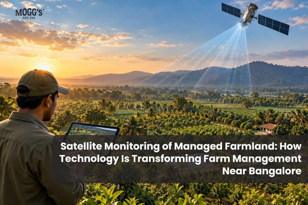
Satellite monitoring in agriculture involves using images and data collected by satellites to observe agricultural land from space.
These satellites capture information about vegetation, soil conditions, surface temperature, and changes in land over time. Farmers and farm managers can use this information to understand crop development and identify areas that may need attention.
Unlike traditional farm inspections, which depend on physically visiting each location, satellite monitoring provides a broader view of the entire agricultural property.
For example, a farm manager can use satellite imagery to compare different sections of an orchard and identify areas where vegetation appears less healthy. This information can then guide on-ground inspections.
Satellite monitoring does not replace farmers or agricultural experts. Instead, it gives them additional information to make better-informed decisions.
For managed farmland owners, this creates an opportunity to understand farm development through technology-supported management.
2. How Satellite Monitoring Helps Improve Farm Management
Satellite monitoring can support several important aspects of agricultural management. Its usefulness depends on the type of satellite data available, the crops being cultivated, and how farm managers interpret the information.
Monitoring Crop Health: A Bird’s-Eye View of Plant Growth
One of the most valuable applications of satellite technology is crop health monitoring.
Satellites can capture information about vegetation using different wavelengths of light. Vegetation indices, such as the Normalized Difference Vegetation Index (NDVI), help estimate the density and condition of green vegetation.
When vegetation indices show unusual changes, farm managers can investigate whether the cause is related to water stress, nutrient deficiencies, pests, disease, or natural variations in the crop.
For managed farmland, this information can help identify areas that need closer attention and support timely agricultural decisions.
Tracking Irrigation and Water Availability: Smarter Water Management
Water management is essential for maintaining agricultural land, particularly during dry periods.
Satellite imagery can help identify variations in vegetation and surface conditions that may indicate possible water-related problems. Some satellite systems also provide land surface temperature data, which can support the assessment of crop water stress.
However, satellite data alone cannot confirm whether a particular plant needs watering. On-ground inspections and soil moisture measurements remain important.
By combining satellite observations with practical farm management, agricultural teams can make more informed irrigation decisions.
Observing Changes Across the Property: Understanding Land Development
Satellite monitoring can help track changes in agricultural land over time.
Farm managers may use satellite images to observe vegetation growth, changes in cultivated areas, and the development of different sections of a property.
This can be particularly useful for large agricultural properties where regular physical inspections require considerable time.
For people exploring Managed farmland for sale , understanding how agricultural land is monitored can provide useful context when evaluating farm management practices.
3. Satellite Monitoring and Modern Managed Farmland
Managed farmland combines agricultural land ownership with professional farm maintenance and management services.
Depending on the property and management plan, these services may include irrigation, plantation maintenance, soil management, crop care, and regular site inspections.
Satellite monitoring can complement these activities by providing a broader view of the property.
For example, a farm manager may compare satellite images from different months to observe changes in vegetation across an orchard. If one section appears different from the surrounding areas, the team can inspect it on the ground and determine whether any action is required.
This combination of technology and practical agricultural knowledge can help improve farm management.
For buyers researching Managed farmland near Bengaluru , it is useful to understand whether the management team uses technology as part of its agricultural operations and how the information is shared with owners.
Technology should support transparent communication and responsible farming rather than replace regular maintenance.
4. Benefits of Satellite Monitoring for Farmland Owners
Satellite monitoring can provide several useful benefits when incorporated into a professional farm management system.
Better Visibility into Agricultural Operations
Satellite images can help owners understand changes across agricultural land without being physically present at the property.
Improved Farm Planning
Observations from satellite data can help management teams identify areas that require closer inspection and plan agricultural activities accordingly.
Early Identification of Potential Issues
Changes in vegetation patterns may highlight areas affected by water stress, poor growth, or other conditions that require investigation.
Long-Term Observation of Land Development
Comparing images over time can help document changes in vegetation and land development.
Support for Informed Decisions
Satellite data, when combined with field observations and agricultural expertise, can provide additional information for farm management.
For individuals considering Farmland investment Bangalore , these benefits may be relevant when assessing how a property is maintained.
However, satellite monitoring does not guarantee higher agricultural yields, increased property value, or a specific investment return. Results depend on several factors, including soil quality, crop selection, weather, water availability, and management practices.
5. Can Satellite Monitoring Help You Evaluate Farmland Before Buying?
Satellite imagery can be a useful starting point when researching agricultural land.
Before purchasing farmland, buyers can examine available satellite images to understand the surrounding landscape, existing vegetation, and visible land-use patterns.
Historical imagery may also help show how the property has changed over time.
However, satellite images cannot establish legal ownership, confirm land boundaries, or prove that agricultural land has clear legal documentation.
A complete evaluation should include physical site inspections, verification of land records, access to water, road connectivity, soil assessment, and professional legal due diligence.
People exploring Farmland for sale near Bangalore should consider both the agricultural potential of the property and the quality of its management.
Similarly, buyers searching for Agricultural land for sale in Bangalore should verify applicable land-use regulations and ownership requirements before making a purchase.
Satellite monitoring is a supporting tool, not a substitute for these essential checks.
6. Satellite Monitoring and the Future of Agriculture
Agriculture is increasingly combining traditional knowledge with digital technology.
Satellite monitoring, drones, soil sensors, weather forecasting, and farm management software are helping agricultural teams collect more information about their land.
These technologies can work together to support more informed decisions.
For example, satellite imagery may highlight an area with unusual vegetation patterns. A drone inspection can then provide a closer visual assessment, while soil testing can help investigate possible causes.
This integrated approach can be useful for orchards, plantations, and larger agricultural properties.
As technology becomes more accessible, it may also support better communication between farm managers and landowners.
For those researching Farmland plots for sale , understanding the role of technology in agriculture can help them ask more informed questions about farm maintenance, monitoring practices, and long-term land management.
7. What to Check When Choosing Managed Farmland
Satellite monitoring is one aspect of modern farm management, but it should not be the only factor considered when evaluating agricultural land.
Before making a decision, buyers should understand:
-
Land documentation: Verify ownership records, boundaries, and applicable legal requirements.
-
Water availability: Understand the property’s water sources and irrigation arrangements.
-
Agricultural planning: Ask about the crops, plantation development, and maintenance schedule.
-
Management services: Clarify what services are included and who is responsible for daily farm operations.
-
Monitoring and reporting: Ask whether satellite images, field reports, or other progress updates are shared with owners.
-
Costs and agreements: Review maintenance charges, contractual obligations, and any additional expenses.
Whether you are researching Premium farmland for sale or comparing Farm plots near Bangalore , these details can help you understand the property beyond its location and appearance.
If you are planning to Buy farmland near Bangalore , take time to evaluate the agricultural, legal, and management aspects together.
Conclusion: A Clearer View of Farmland Through Technology
Satellite monitoring is changing how agricultural land can be observed and managed. By providing information about vegetation, land conditions, and changes over time, satellite technology can support farm managers in making more informed decisions.
For managed farmland, it offers an additional layer of visibility into agricultural operations. When combined with regular field inspections, responsible farming practices, and professional management, it can contribute to more systematic farm maintenance.
At the same time, technology is only one part of successful agriculture. Healthy soil, suitable crops, water management, experienced farm teams, and consistent care remain essential.
As interest in Agricultural land near Bangalore continues, understanding modern farm management practices can help prospective buyers make more informed decisions.
The future of agriculture is not about replacing nature with technology. It is about using technology to understand nature better and manage agricultural land more responsibly.